We completed the Tour du Mont Blanc self guided in two halves. One half from Chamonix to Courmayeur one summer and the remaining trail from Courmayeur to Chamonix the next Summer.
This post describes trekking through the Italian Alps following stage 5 of the Tour du Mont Blanc trail from Courmayeur to Refugio Bonatti.
Read our Ultimate Tour du Mont Blanc Self Guided post here.
Tour du Mont Blanc Hike
Read our day by day accounts on hiking the Tour du Mont Blanc with kids. Our itinerary covers all the most spectacular sections and includes details of how to cut trail times for families or older generations.
This post is on Day 1 of our second summer hiking the TMB. We hike from Courmayeur to Refugio Bonatti in Italy.
Click here to read the stage before (Refuge Elisabetta to Courmayeur). Links to all other days on our first half of the TMB trek and our second half of the TMB of can be found at the bottom of the post.
Day 1 (stage 5) Tour du Mont Blanc – Courmayeur to Refuge Bonatti – Italy
Hike time:
9 hrs with kids stopping frequently (compared to 4.5 hours, without stops, in the Cicerone guide)
Hike length:
12 km
Water fill ups?
Refugio Bertone
Trail Overview
This trek continues through Italy. There are no cols to climb on stage 5 of the Tour du Mont Blanc trek but the slog upwards (elevation gain 860m) from Courmayeur to Refuge Bertone will test you. Know that at the top Refugio Bertone is waiting patiently for your mid morning or lunch time arrival with friendly staff, strong coffee and simple, delicious Italian dishes.
The good thing is that once that first climb is out of the way, the traditional route is an easy meander along a long traverse high above Val Ferret to the fantastic Refugio Bonatti (2025m) arguably one of the best refuges on the entire Tour du Mont Blanc.
Short Cuts
The only short cut on this stage of the TMB is only recommended in severely bad weather as it cuts out the entire trail but does get you to Refuge Bonatti.
Bus No 5 from Place Le Monte Bianco (2 mins from our hotel) runs along the valley floor of Val Ferret and can drop you at stop “Bivio Refugio Bonatti’. This stop is located slap bang at the bottom of the vertical trail that leads straight up to Refugio Bonatti. The hike will take roughly an hour. The bus is 2 euros one way.
If you’re trekking the entire Tour du Mont Blanc circuit in one go, you’ll have stayed in Courmayeur the night after hiking from either Refugio Elisabetta or Cabane Combal the day before.
For those of you who are hiking the Tour du Mont Blanc over two summers, you will be starting your TMB trek in Courmayeur. Jump to our section on How to get to Courmayeur if I’m starting the TMB there.
Getting to Courmayeur via the Mont Blanc Panoramic
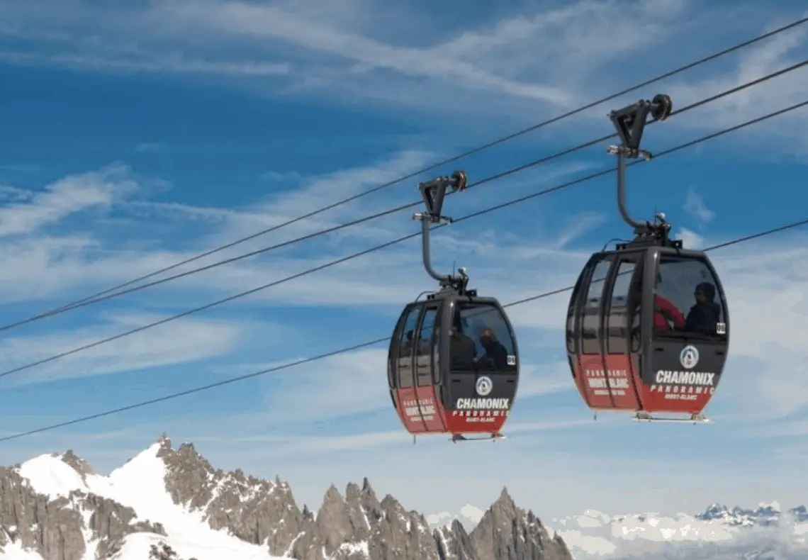
There’s also the option of catching a series of five cable cars over to Courmayeur from Chamonix. The ticket is called Mont Blanc Panoramic. It includes a bus ticket back to Chamonix but of course, you won’t need that as you’ll be trekking it.
Whilst this is an unbelievably dreamy way of getting to Courmayeur (passing Mont Blanc!) don’t get your hopes up. This is ONLY an option if the weather is PERFECT. The service is often cancelled due to wind or bad weather which means this route is certainly not dependable. Thus this is only an option for the trekker who can change plan easily and opt to take the bus if the service is not running.
In fact it’s not possible to book this ticket in advance as it is so often fermé. My recommendation is, if you are in Chamonix go along to the Aiguille du Midi lift station and ask the cash desk for information on the Panoramic for the following day. They might be able to give you an idea of the weather forecast and whether it’s likely to run. If you’re trying to find out online as to whether it will open, have a look firstly at the Chamonix weather information (www.chamonix-meteo.com is best)and online at the Mont Blanc Natural Resort website who run the lift.
It’s certainly a fabulous way of getting to Courmayeur and an incredible way to start your Tour du Mont Blanc. It is pricy though at €129 per person.
Read more: Tour du Mont Blanc Packing List
Tour du Mont Blanc: Courmayeur – Refugio Bonatti – 12 kms
We were blessed with fabulous weather in 2018 when we trekked the first half of the TMB. So the bad weather brooding on the met check (which seemed to get worse with every hourly check) worried me in our Courmayeur hotel room, the eve before we were due to set off to complete our TMB trail. With two kids hiking with us, both aged 11, I didn’t want to be caught out on the trail in the middle of a summer storm.
As a precaution I’d checked with the Courmayeur tourist office and if I deemed the weather to be too dangerous, we’d reluctantly take the No 5 bus (2 euros 1 way) from Place Le Monte Bianco (2 mins from our hotel) which would take us along the valley floor of the Val Ferret and drop us at “Bivio Refugio Bonatti’ right at the bottom of a trail that would lead us up vertically straight up to Refugio Bonatti in a mere hour. A great plan should conditions be shockingly dire, but a hard decision to make.
Come the morning, the weather report had brightened slightly with estimated gale force winds reducing to heavy rain showers. We went for it!
READ MORE: Transport options on the TMB
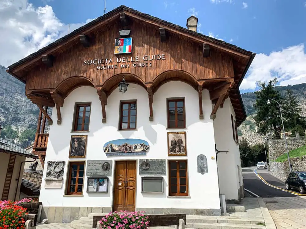
The start point of the TMB from Courmayeur centre is from the central church next to the Guides office. Take the road to the left which leads to the trail start point
Setting off at 8.30am we walked the five minutes into town and easily found the street Strada del Villair that peels off up the hill to the left of the guides office, next to the main church.
After 20 minutes of uphill, we peeled off the road onto a well signed posted track through the countryside, leaving Courmayeur behind us and stopped to put on our waterproofs as angry clouds above pelted us with rain.
The trail soon comes to a large clearing with a wooden bridge over a series of stepped waterfalls.
The trail becomes narrower and steeper now through thick woodland.
Read more: Tour du Mont Blanc Refuges – the good, the bad & the ugly
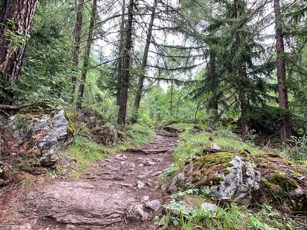
It’s now an uphill slog with only glimpses through gaps in the trees of Courmayeur and the valley below. The path zig zags up through the forest to Refugio Bertone, waiting patiently at the top.
It took us 2 hours to climb with kids in the rain (the Cicerone guide books states 1.5 hours, without stops) so I reckon we did alright!
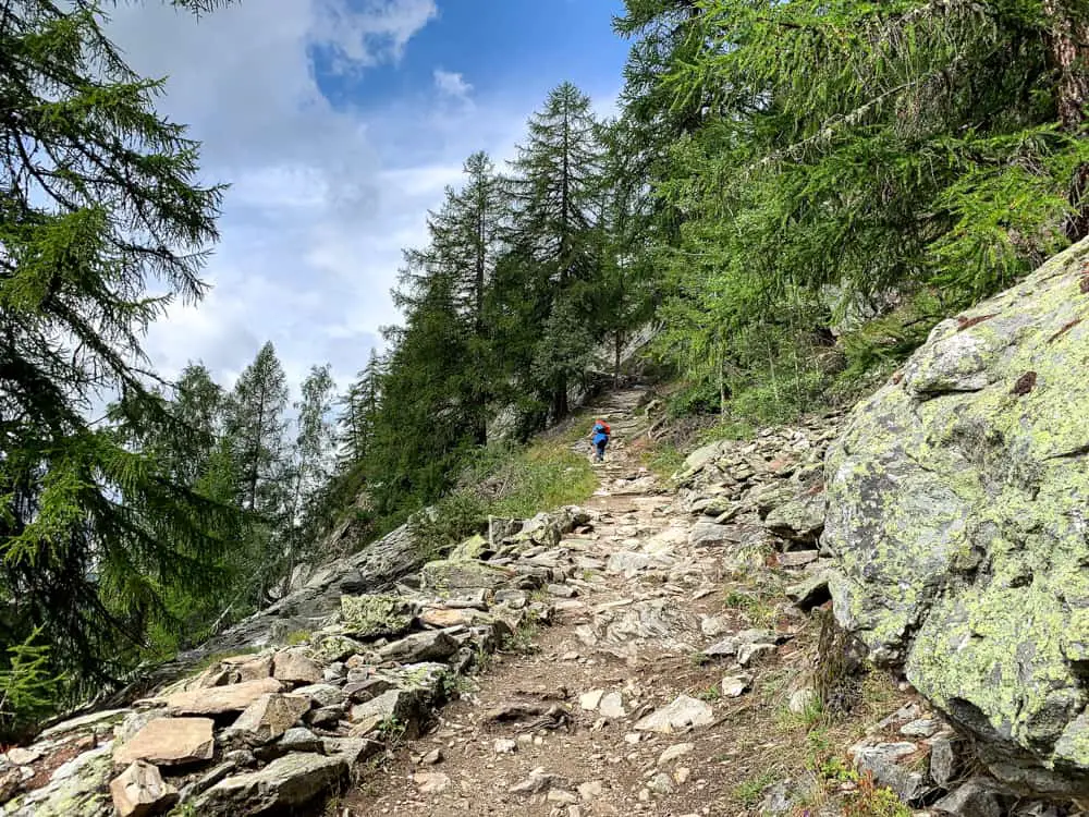
What kept us going on the 2 hour climb was knowing that once we got to Refuge Bertone, our elevation gain was pretty much done for the day. Hooray.
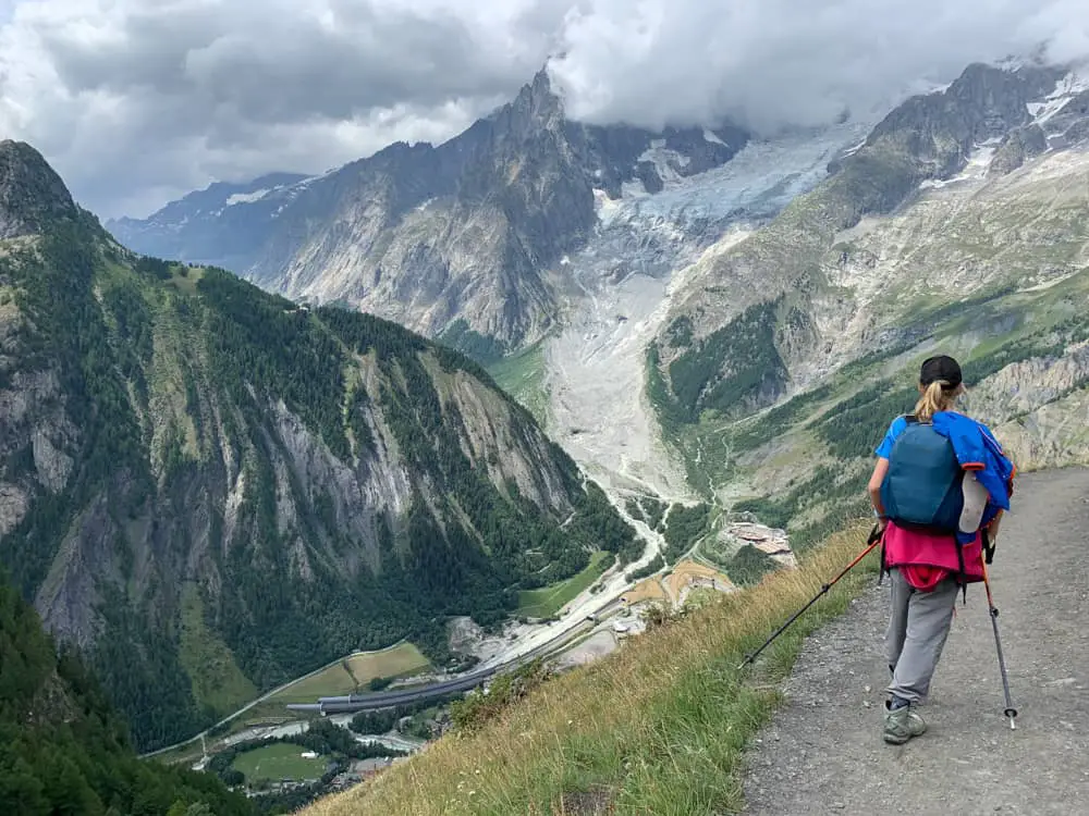
All of a sudden the trees dwindle away and if you turn to your right, you can see Refugio Bertone perched high on the mountain above you. Here, continue forward to an excellent view point overlooking Mont Blanc and the Aiguille Noire and Courmayeur far below.

Almost there! The trail from Courmayeur starts immediately up with no let up until you reach Refuge Bertone (around 2 hours)
Now Refuge Bertone is so early on the trail that it seems too soon to stop. But once you’ve got that steep elevation under your belt, trust me, take a breather at Refuge Bertone!
In fact have an early lunch – the food here is simple Italian but bloody good. Food doesn’t start being served until 12.30 but kick back with a coffee or a soft drink and take in the views. The rest of the route for the remainder of the day is an enjoyable meander and so it’s not necessary to rush unless inclement weather is expected.
Hiking in Italy, it has to be said, is a true joy. The food is always simple, super fresh, delicious and cheap. The refuges are charming and the people laid back and friendly.
The prices at Refugio Bertone are very reasonable (most of Italy is!) so take advantage of the getting more bang for your buck before Switzerland cripples your wallet in just a few days time. (drink prices at Refugio Bertone: sprite 3 euro, latte 3 euro).

Refugio Bertone is a very friendly Refugio with reasonably priced drinks & food. Relax here after your uphill slog – the rest of your trek today will be at a much more relaxed pace. View looking down onto Courmayeur.
After a leisurely lunch outside at Refugio Bertone with the sun shining on our grateful faces, we left the refuge at 1.30pm.
The route climbs up past the refuge and around to the left. Continue up and over for those trekking the variant route (previously the original route) along the Mont de la Saxe ridge. It’s a route I’d love to do one day but certainly not in bad weather and with the extra elevation gain required (around an extra 600m) perhaps not with kids in tow.
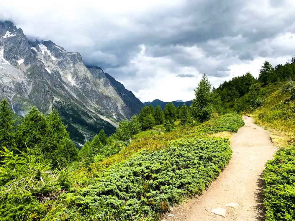
We took the easier now standard Tour du Mont Blanc route which follows an easy traverse along the top of the Val Ferret flank of Mont de la Saxe. After the strenuous uphill of this morning, we all burst out into song as we ease along the trail, weaving through juniper and bilberry bushes.
The iced peaks of the Dent du Géant (4013m), Dôme de Rochefort (4,015m and the Grandes Jorasses (4,208m) across the valley are sadly hidden from view by heavy clouds in a broody sky, but they’re high enough for us to see the spectacular tongues of ice snaking down between jagged rock faces.
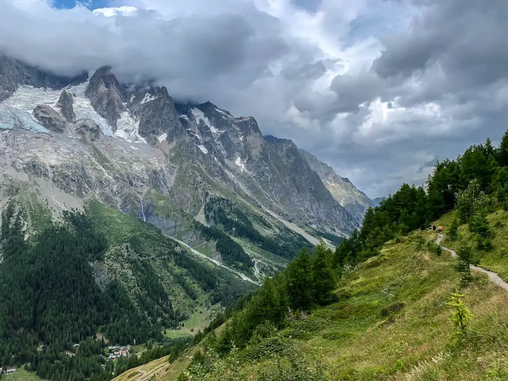
It takes us a further 4 hours to walk to Refuge Bonatti. Now ladies and gentlemen bear in mind this time frame includes the finding of an injured baby chick and many many stops along the route! The Cicerone guide states 2.5 hours to walk this long traverse to Refuge Bonatti. The Cicerone guide always gives trek times without stops. I’d estimate at 3-3.5 hours without kids.
Unfortunately the weather was against us. Rain and cloud rolled in periodically so we were only afforded fleeting glimpses of the majestic views across Val Ferret.
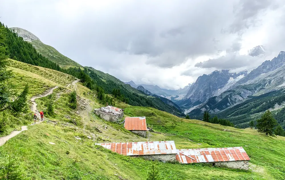
There’s no where else to stop on this section now until you get to Refuge Bonatti, but you’ll be able to fill up your water bottle soon if you’re low on water.
You’ll pass several ruined cattle sheds, continue straight and you’ll eventually turn a spur and descends to a stream and a charming wooden bridge. The trail takes you right past the old rustic buildings of Alp Arminaz (2033m). Seemingly derelict from the ramshackle exterior, the trail of smoke from the chimney told a different story.

This section is spectacular, I know, as I’ve x country skied the valley bottom many times during winter when the valley is closed to traffic and boasts a 10km x country trail. It’s incredible and something that if you’re in the area in winter, you should definitely do.
It’s staggering beautiful, so we were sad not to take in the beauty on this occasion. If the weather is on your side, believe me, you will enjoy this section immensely.

The traverse along this flank that seemed so gentle, will still seem weary as you finally see Refuge Bonatti above you to your right. It’s then one last push up the 100m steep slope to the refuge immediately above you.
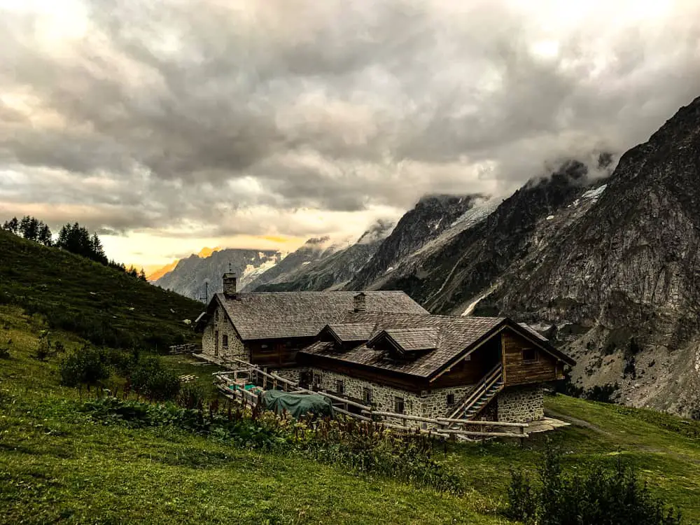
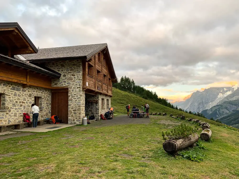
Refuge Walter Bonatti deserves it’s reputation as being one of the best TMB refuges on the trail. This private family run refuge will not disappoint
Refuge Walter Bonatti is a private, family run hut. It’s ambiance is very welcoming and super friendly. Black and white photos cover the walls of the famous Italian guide Walter Bonatti. The refuge is very well organised (unlike Refugio Elisabetta!) and it’s clear that the family love what they do.
Refuge Bonatti has been completely renovated so it’s a veritable palace in hut terms. The dorms have plenty of space & cubbie holes for your belongings. Plus there are private rooms if you’d prefer your own space. Book early for these. There is a large electronics charging station – fabulous! The bathrooms are large and clean, with astonishingly, foot baths!
Shower are free showers, but you’ll need to get a token from the bar. I had a lovely long hot shower after dinner long hot but in morning it kept stopping after 30 secs.
The staff are extremely helpful, even in peak season when the hut is packed and there’s a queue at the bar!
The food is amazing. Dinner is served at 18.45. Our dinner consisted of salad to start, followed by a delicious bean soup, and then a main dish of an egg tartlet, served with mash & cabbage and finished with a choc & pear dessert.
The bar is open until 21.30 and lights out is at 22.00pm. The wine is both excellent quality and an excellent price – €6.00 for a half litre!
The pique nique (€12.00) available for the next day’s lunch is brilliant. Make sure you order this in the evening as it will be too late in the morning. Ours consisted of a ham & cheese sandwich, an individual Pantone cake (delicious traditional Italian cake), a square slab of dark chocolate with Bonatti written into it, and a piece of fruit (clementine).
How to get to Courmayeur if I’m starting the TMB there?
You can either fly into Geneva and get an airport transfer direct to Courmayeur. Or you can get an airport transfer to Chamonix, spend a few days there to acclimatise and then get a bus through the Mont Blanc tunnel.
SAT buses run frequently from Chamonix Bus Station and you can buy tickets online (€15 one way ‘aller simple’). It takes 45 minutes to get from Chamonix to the main bus station in Courmayeur.
Easybus run reliable frequent mini bus direct services from Geneva airport to Chamonix bust station. Prices start around €16 one way. The website is easy to book and in English.
Flix Bus is a large coach service which runs to Chamonix and direct to Courmayeur. Note even direct services to Courmayeur (2hr 30 mins) will most probably stop in Chamonix as Courmayeur is reached through the Mont Blanc tunnel accessed in Chamonix. Prices are as low as €7.99 and their website is easy to book and in English.
If you want door to door service to either Chamonix or Courmayeur then book through a shared transfer company such as CVT or Mountain Drop-offs. Cost approximately €35 per person one way in a shared shuttle bus.
Read more of our posts on the Tour du Mont Blanc here:
Read day 1 (stage 10) Tré-le-Champ to La Flégère
Read day 2 (stage 11) La Flégère to Les Houches
Read day 3 (stage 1) Les Houches to Les Contamines (& onto Nant Borrant refuge)
Read day 4 (stage 2) Nant Borrant Refuge to Les Chapieux
Read day 5 (stage 3) Les Chapieux to Refugio Elisabetta
Read day 6 – Tour du Mont Blanc – Stage 4 – Rifugio Elisabetta to Courmayeur
Tour du Mont Blanc Packing List
Ultimate guide to your self guided Tour du Mont Blanc
Tour du Mont Blanc Refuges – the good, the bad & the ugly
Tour du Mont Blanc Difficulty? Transport options on the TMB

