

Trekking the Tour du Mont Blanc with kids is possible. Make sure you’ve done your homework & research the trail as well as taking public transport options to help save tired legs
Trek Mont Blanc as a family
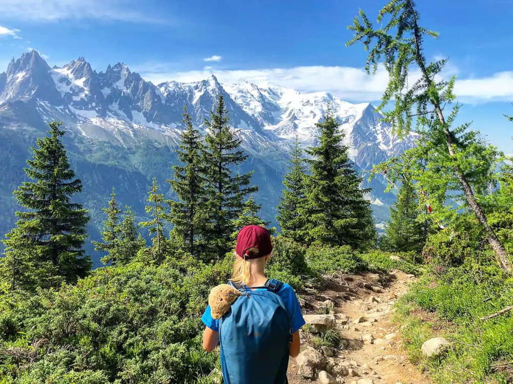
Today we officially started operation TMB. We’re going to be completing half of this classic 11 day trek which travels around Mont Blanc, the highest point in Western Europe and through 3 countries.
TRÉ-LE-CHAMP – FLÉGÈRE
This is traditionally the 10th day on the anti-clockwise (traditional) route of the TMB. We’ve used it as our start point, as oppose to the traditional start point of Les Houches at the other end of the Chamonix valley. This is because we are only hiking half the TMB route, not the entire route and we didn’t want to miss out on some of the most spectacular scenery on the tour, the Grand Balcon Sud, which are on the last two days of the traditional trail route. The Grand Balcon Sud has jaw dropping views over to Mont Blanc and the Bossons glacier. It’s unmissable.
You can of course decide where to start anywhere on the trail, but it’s easier to start from one of the main towns in each country. Chamonix or Les Contamines in France, Courmayeur in Italy or Champex in Switzerland.
For us, based in Chamonix, we day hiked two stages (10 & 11 in the book), returning home each night before completing a 4 day hike from Les Houches over to Courmayeur on the Italian side of Monte Bianco.
 For those of you (most of you) travelling to Chamonix to start the trek, if you are following our 6 day itinerary (which we think takes in all the most spectacular sights of the TMB) either stay the night in Chamonix and catch a taxi up to our starting point at Tré-le-Champ (the car park on the Col du Montets) or stay the night in one of the best refuges on the trail, La Boerne, in Tré-le-Champ and roll out of bed straight onto the trail.
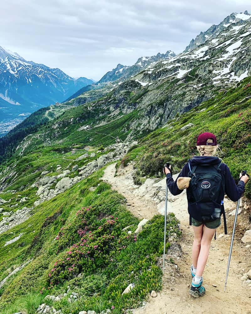
This Tré-le-Champ to Plan Praz at La Flegere (stage 10 in the book) is one of the shortest of the whole TMB trail. The guide book states 3.5 – 4 hours so it gave my just turned 10 year old an easy first day. In fact, it took us just over 5hrs in total but this was with lots and lots of stopping to snack, rest and sketch along the way. I talk a lot about our timings in our itinerary posts, to give you an idea of time hiking the trail with kids. This was something that was genuinely hard to determine before actually walking the trail itself. It will give you more of an idea how to plan your own TMB, depending on the age of your kids etc.
Starting point:
The car park on the left on the main road leading up to the Col du Montets (where the tiny chapel is), you’ll see an information board with signposts for Aiguillette d’Argentiere. This is where the trail starts.
Good to know:
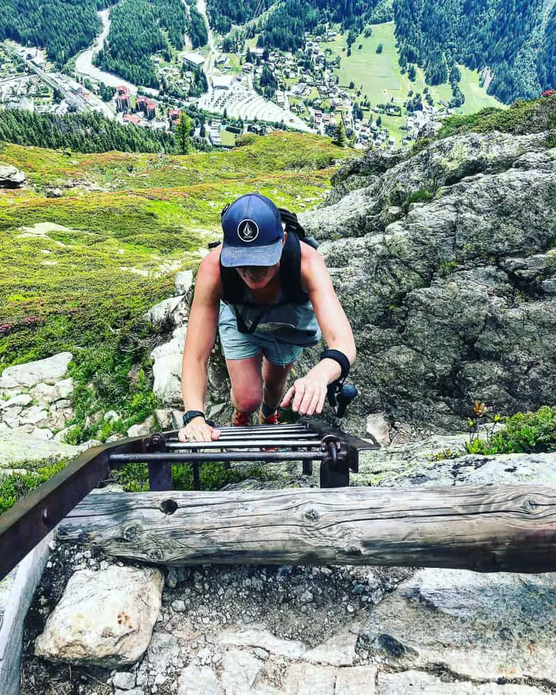
This route takes in the famous TMB metal ladders just around an hour and a half into the route to navigate over some of the vertical rock crag. My 10 year old daughter and I found it easy enough but for those who don’t like heights, you might want to consider taking the alternative route, which starts slightly further up the Col de Montets, (1km more) to complete. Check out my post on these TMB ladders here which talks about them in more detail with lots of photos, so you can decide for yourself during the planning stage of your TMB, rather than being one of the group of hikers we’ve seen that have been forced to turn around.
The route overview:
The route is an uphill climb for between 1.5-2 hrs (with kids) until you reach the first ladders, and then a further hour up to reach highest point of the day, a large cairn, Tête aux Vents (2132m) which marks the edge of the national park. From there the trail descends and winds down for a further 2 hours to the ski fields of La Flegere, finishing at Plan Praz, the cable car station. This route gives fantastic bird eye views over Argentiere and stunning vistas over to Mont Blanc. It is the easiest day on the TMB trail on our 6 day itinerary.
Accommodation options:
Stay the night in either the Lac Blanc refuge, an extra 30 minutes climb to get to but a spectacular setting, or Refuge de la Flegere. If you opt for the spectacular setting of the Lac Blanc refuge, note it would add another 1 hour to your trail time the next day.
Alternatively you can catch the La Flegere cable car down from Plan Praz (the mid station at La Flegere) to the valley floor to stay in the village of Les Praz (or catch a 7 min bus ride to Chamonix town), picking up the trail the next day.
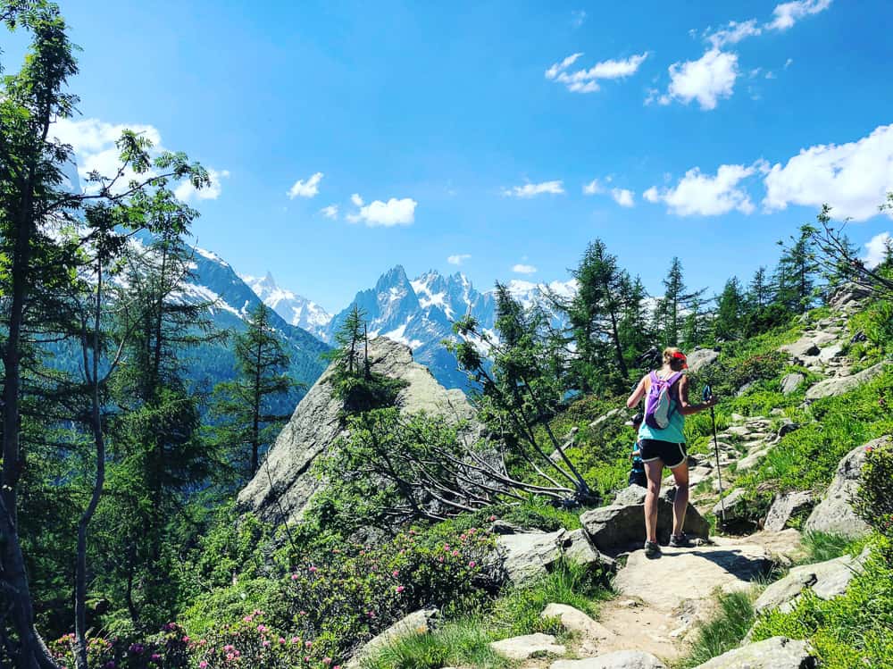
 We started the hike at 8.20am and there were already hikers on the trail. The hike starts gently uphill through a wooded (shady) forest, passing a sweet minuscule chocolate box chalet on your left. If it’s unoccupied skirt around it to it’s decking platform for a fantastic view of the Argentiere glacier.
From here it’s a pleasant stroll through woodland with plenty of flower in bloom. We hiked this section on 24 June. There was no snow still on the actual trail but plenty on the mountains around.
The first junction you come to is well signposted. Turn downhill to the left to Argentiere or right up to the Aiguillette d’Argentiere. Bear left and continue climbing up the steep path where eventually you will break out of the trees for unrivalled scenery on your left of the Mont Blanc massif. Hope that you have good weather for this stage as it would be a shame to miss the spectacular vistas that this section shares.
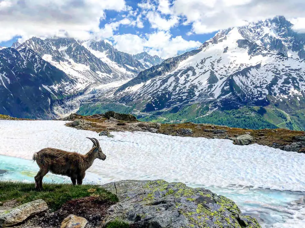
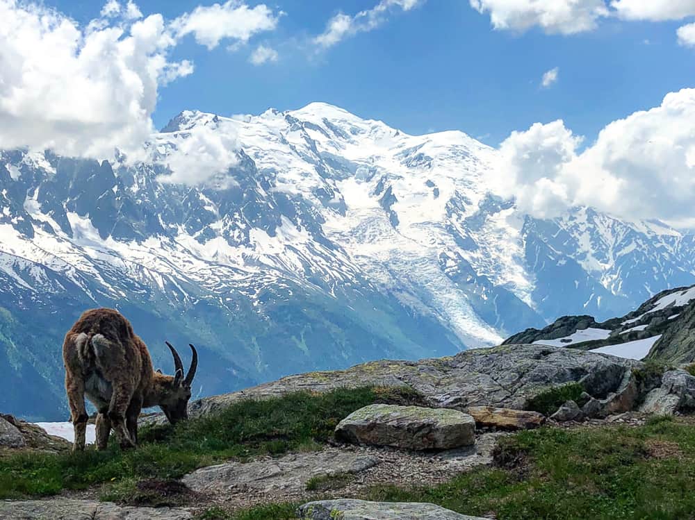
 As you break out from the trees, you’ll be in full sun with a huge crag above you. The path winds back and forth to then skirt the crag on the approach to the famous Aiguillette d’Argentiere. The landscape is now strewn with boulders and rock slabs. Look closely at the crag. We spotted several chamonix and a huge ibex here that blended seamlessly into the landscape.
>>>>> – – – – – >>>>> – – – – – >>>>> – – – – – >>>>> – – – – – >>>>> – – – – – >>>>> – – – – – >>>>>
Read our post
Tour du Mont Blanc Packing List
>>>>> – – – – – >>>>> – – – – – >>>>> – – – – – >>>>> – – – – – >>>>> – – – – – >>>>> – – – – – >>>>>
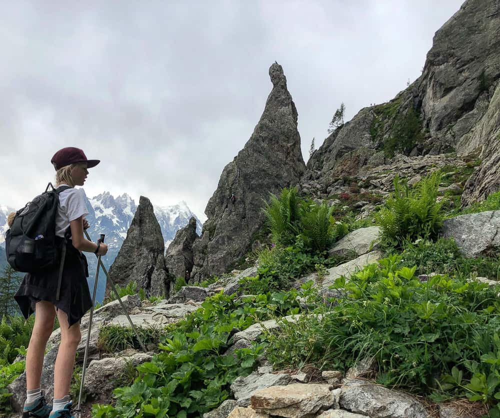
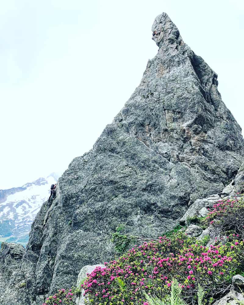
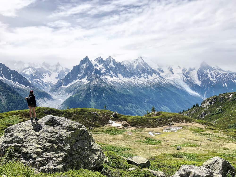
 It takes about around an hour and a half of uphill hiking from the start point before the pinnacle, Aiguillette d’Argentiere (1893m) comes into view. This iconic monolithic slab of rock is a popular climbing spot and it’s a great place to take a rest and watch with awe as nimble climbers make their ascents.
>>>>> – – – – – >>>>> – – – – – >>>>> – – – – – >>>>> – – – – – >>>>> – – – – – >>>>> – – – – – >>>>>
Planning to camp on the TMB?
Read our review on the lightweight, pack small
Vango F10 Aero self inflating sleeping mat
>>>>> – – – – – >>>>> – – – – – >>>>> – – – – – >>>>> – – – – – >>>>> – – – – – >>>>> – – – – – >>>>>
 As you can tell from the skies in the photos, I’ve actually done this section of the trail twice. I was worrying about the ladders and whether I should trek the alternative route with my 10 year old which misses out the ladders completely. So, with the advantage of being based in Chamonix, I walked this route before hand to examine the ladders first hand. In the below photo, you can spot a climber on the top of the rock pinnacle and also two trekkers half way down the crag on the right – this is the top of the ladders.
>>>>> – – – – – >>>>> – – – – – >>>>> – – – – – >>>>> – – – – – >>>>> – – – – – >>>>> – – – – – >>>>>
Read our post
Public Transport Options on the TMB – Perfect for Hiking with Kids
>>>>> – – – – – >>>>> – – – – – >>>>> – – – – – >>>>> – – – – – >>>>> – – – – – >>>>> – – – – – >>>>>
 We reach the pinnacle at 10.10 so it’s taken us 1hr 50mins to reach this point, bearing in mind we stop a lot to take photos and stopped to sketch under the crag. We rest for 10 minutes here and check out the ladders. There’s a few hikers in front of us waiting to climb them and also hikers coming down.
>>>>> – – – – – >>>>> – – – – – >>>>> – – – – – >>>>> – – – – – >>>>> – – – – – >>>>> – – – – – >>>>>
Read our post
The Tour du Mont Blanc Refuges – the good, the bad & the ugly
>>>>> – – – – – >>>>> – – – – – >>>>> – – – – – >>>>> – – – – – >>>>> – – – – – >>>>> – – – – – >>>>>
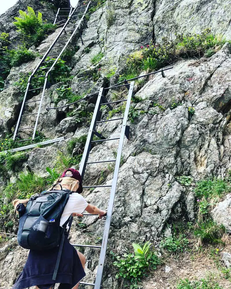
 Obviously there’s only room for one person to negotiate the ladder each way so it’s a waiting game until the ladders are clear. We had a few hikers come up behind us while we were waiting and we were happy to wave them in front of us so that there was no pressure and we could climb them in our own time and enjoy them. The first section of ladders is a set of three. Two mediums and a small one. They are not completely vertical and so we felt really safe. It’s not too scary and in fact we both loved it. My daughter said it was one of the best things we did on the TMB, so don’t worry about your kids on them too much.
>>>>> – – – – – >>>>> – – – – – >>>>> – – – – – >>>>> – – – – – >>>>> – – – – – >>>>> – – – – – >>>>>
It’s mandatory to take a sleeping bag liner with you to stay in the TMB refuges
Read our RAB silk sleeping bag liner review here
>>>>> – – – – – >>>>> – – – – – >>>>> – – – – – >>>>> – – – – – >>>>> – – – – – >>>>> – – – – – >>>>>
 I have written another post, purely dedicated to these ladders, so if you’re nervous about climbing this section and want to check out a ton of other photos, then go over to this post and have a read.
There are 9 ladders in total we counted, as well as various sections of metal ware and steps to navigate the crag. It takes around 30 minutes to finish this section but it peters out as you go on with less and less metal ware to negotiate.
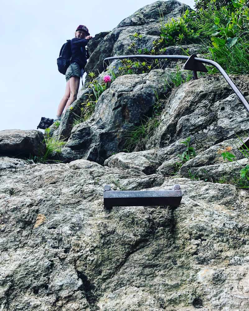 As you can see the path negotiating this steep crag is quite narrow and on the edge a lot of the time. I didn’t feel unsafe in the least but if you’re of a nervous disposition, check out the alternative TMB route that misses out these ladders completely.
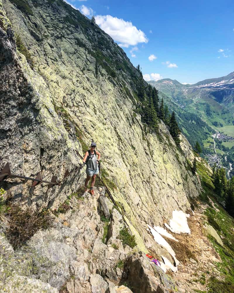 This route I think however is just made by these ladders. It really spices up the TMB route, especially for kids who love this kind of thing. The birds eye views down to Argentiere, 800 metres, below are fabulous. The fan, triangular area you can see in the background below is the Grand Montets carpark!
 We continue to climb uphill for a further 50 minutes until we reach a large cairn, the Tête aux Vents (2132m) which marks the edge of the national park and is the highest point on this day’s hike (unless you’re heading to Lac Blanc refuge (2352m) for the night, in which case you’ll be climbing up a further 220m).
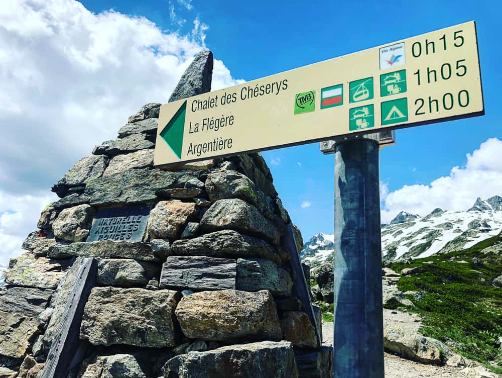
 This junction of paths is a good rest point. The path to the right (sign posted Col des Montets) is the adjoining alternative path up from the Col des Montets that avoids the ladders. Straight ahead is the path to Lac Blanc (and the refuge) and Lac des Chesereys, while the traditional route of the TMB turns left (see signpost below) to Chalet des Chéserys (ruins) and La Flegere.
We reached this point at 11.35am so had been hiking for 3 hours and 15 minutes.
You can see from the signpost below that it indicates 1h 05 minutes to Flegere. These signposts are actually fairly accurate. It took us 1 hr 55 minutes from this cairn to La Flegere but we did eat lunch and stop at the stream for a break.
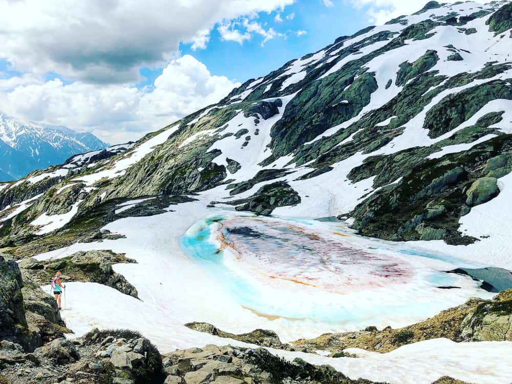
 On my previous reccy trip a week earlier (20 June) I continued up to Lac Chesereys. There was a lot more snow the week before and I was glad that the temperatures had been so hot in the week since so a lot of the snow had melted. You can see how much snow was still on the trail in the photo below. There had been a LOT of snow that winter and you can see how the trail can sometimes be closed up until the last week of June if there’s been a lot of snow the winter before. Bear this in mind before making your TMB bookings, especially if you’re travelling from overseas to trek the route.
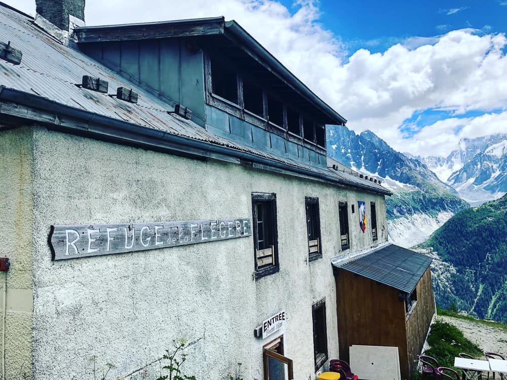
 The path winds down and traverses across the mountain towards La Flegere. You can see the lift station at La Flegere in the distance in the photo below. That is the end point of today’s section of the TMB where you can stay in the La Flegere refuge or opt to take the cable car down into the valley to stay at a hotel or B&B in Les Praz, the village the cable car goes down to, or Chamonix, a 7 minute bus ride along the valley.
If you’re thinking of staying the night at the Lac Blanc refuge (which we have not yet done) but is highly acclaimed, note that this hiking day would then be extremely short (around 4 hours) and you’d have a further 1 hr 10 mins the next day to hike to La Flegere. If you are not restricted in time and want to shorten the TMB sections because you’re hiking with kids, you could opt to stay at Lac Blanc refuge and then hike the next day to Refuge Bellachat.
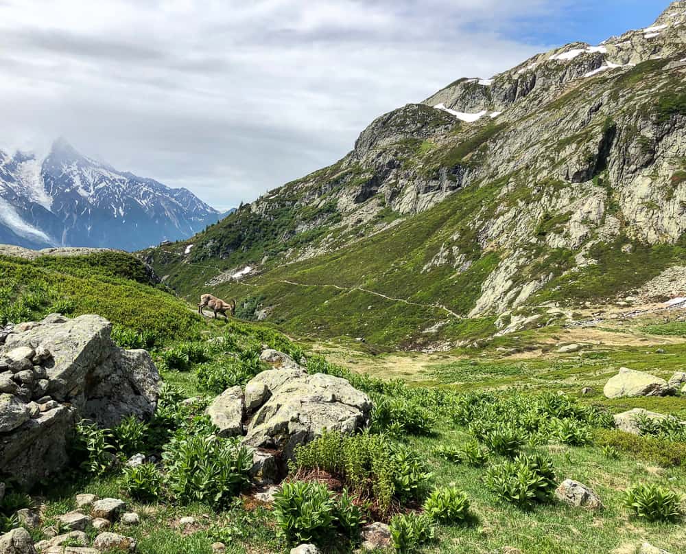
 The route descends easily through meadows and a plateux. We spotted fearless chamois here, clearly used to humans and not bothered at all about our presence. You can see the white snow capped dome of Mont Blanc in the distance in the photo below.
 These views are why we added stages 10 and 11 to our day 1 and day 2 of our itinerary. If you only have a week to hike some of the TMB, you definitely don’t want to miss the spectacular views from the Grand Balcon Sud.
 The trail undulates towards a stream in the distance. Again see the chamois busy doing it’s thing. The stream is fed from a high waterfall from Lac Blanc and it took us 45 minutes from the cairn to reach it.
 It’s a good spot to rest a while and fill up your water bottle. At this point the time is 12.26 and we’ve been on the trail for 4hrs and 5 minutes.
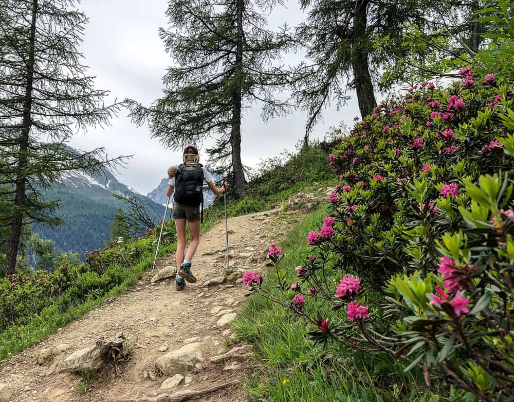
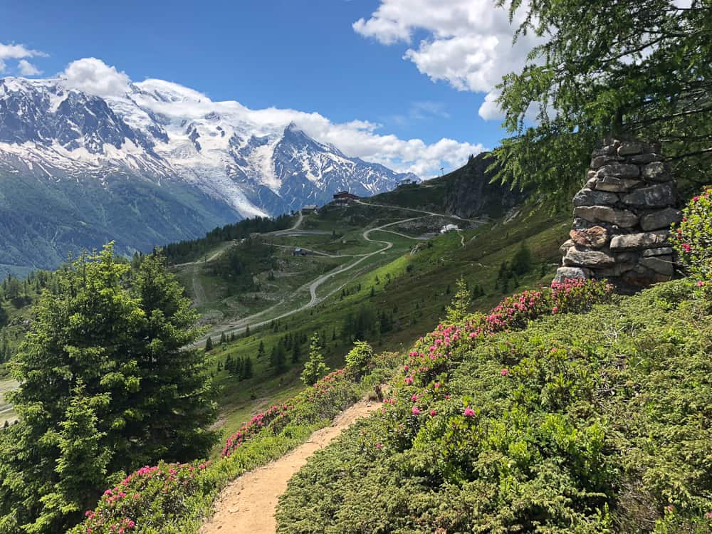
 As you continue towards La Flegere there are swathes of beautiful pink azaleas growing on the mountainside.
Ahead of you, you can see the ski pistes scarring the mountain as the cable car building gets closer and closer.
After 2 hours of walking from the cairn at Tête aux Vents we reach the La Flegere cable car and just below it the Refuge de la Flegere. There’s a tiny buvette stand selling snacks and refreshments just before the cable car. You can now descend into the valley if you’ve chosen to stay in more luxurious accommodation offered in the town of Chamonix or village of Les Praz over the more basic refuges (Lac Blanc refuge or Refuge de la Flegere), however bear in mind that the cost of getting down and back up the mountain again is quite pricey and almost what a night in a refuge would cost.
A one ticket on the cable car is €24.50 for adults and €20.80 for children.
Related TMB content
Read day 1 (stage 10) Tré-le-Champ to La Flégère
Read day 2 (stage 11) La Flégère to Les Houches
Read day 3 (stage 1) Les Houches to Les Contamines (& onto Nant Borrant refuge)
Read day 4 (stage 2) Nant Borrant Refuge to Les Chapieux
Read day 5 (stage 3) Les Chapieux to Refugio Elisabetta
Read day 6 – Tour du Mont Blanc – Stage 4 – Rifugio Elisabetta to Courmayeur
Tour du Mont Blanc Packing List
Ultimate guide to your self guided Tour du Mont Blanc
Tour du Mont Blanc Refuges – the good, the bad & the ugly
Tour du Mont Blanc Difficulty? Transport options on the TMB