

Tour du Mont Blanc Blog
Our Tour du Mont Blanc blog posts include what to expect day to day on each leg of the half circuit of the Tour du Mont Blanc from Très-Le-Champ in France to Courmayeur in Italy.
Importantly, we talk about realistic hike times trekking with kids and how to slash some of the trail times, making this trek doable as a family. By using some of the public transport along mundane valley stretches or cable cars up and down the mountains, it’s possible to reduce hiking times to save little legs on this epic world classic trek.
This post details Day 3 on our Tour du Mont Blanc itinerary from Les Houches in the Chamonix valley to Les Contamines and further on to the next refuge – Nant Borrant.
Click here to read about the day before – Day 2 La Flégère to Les Houches
Click here to read about the day after – Day 4 Nant Borrant to Les Chapieux
Day 3 (Stage 1) – Les Houches to Les Contamines (and further on to the first refuge Nant Borrant)
Hike time:
6.5 – 7 hours (5 hours from Bellevue plateau to the main road leading to Les Contamines, 30 mins bus journey, 1hr hike up to Nant Borrant)
Hike length:
10km hiking (from the top of Bellevue to Nant Borrant) + 5.9km via bus in-between
Water fill ups?
Yes, lots. Stream between Bionnassay & L’Ormey. Water fountains at most hamlets & villages.
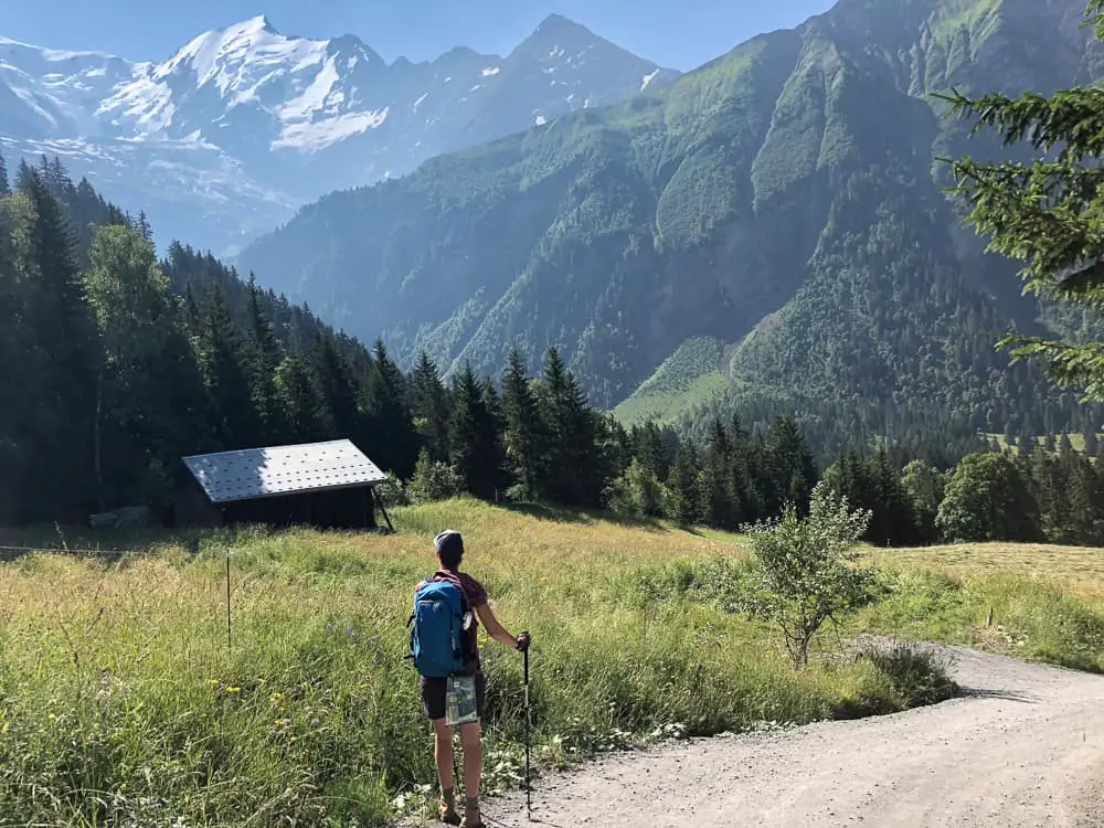
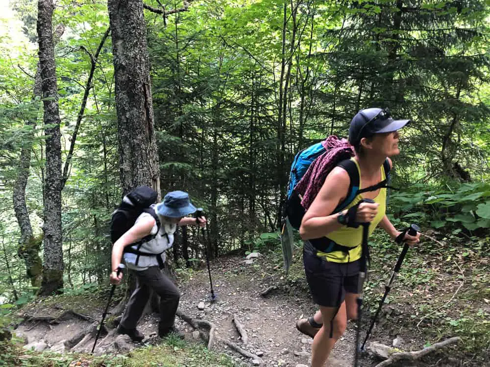
Les Houches to Les Contamines is seen as the first official day on the trek, as most people start from Les Houches and trek counter-clockwise which allows you to hike the best direction for the most splendid views of Mont Blanc.
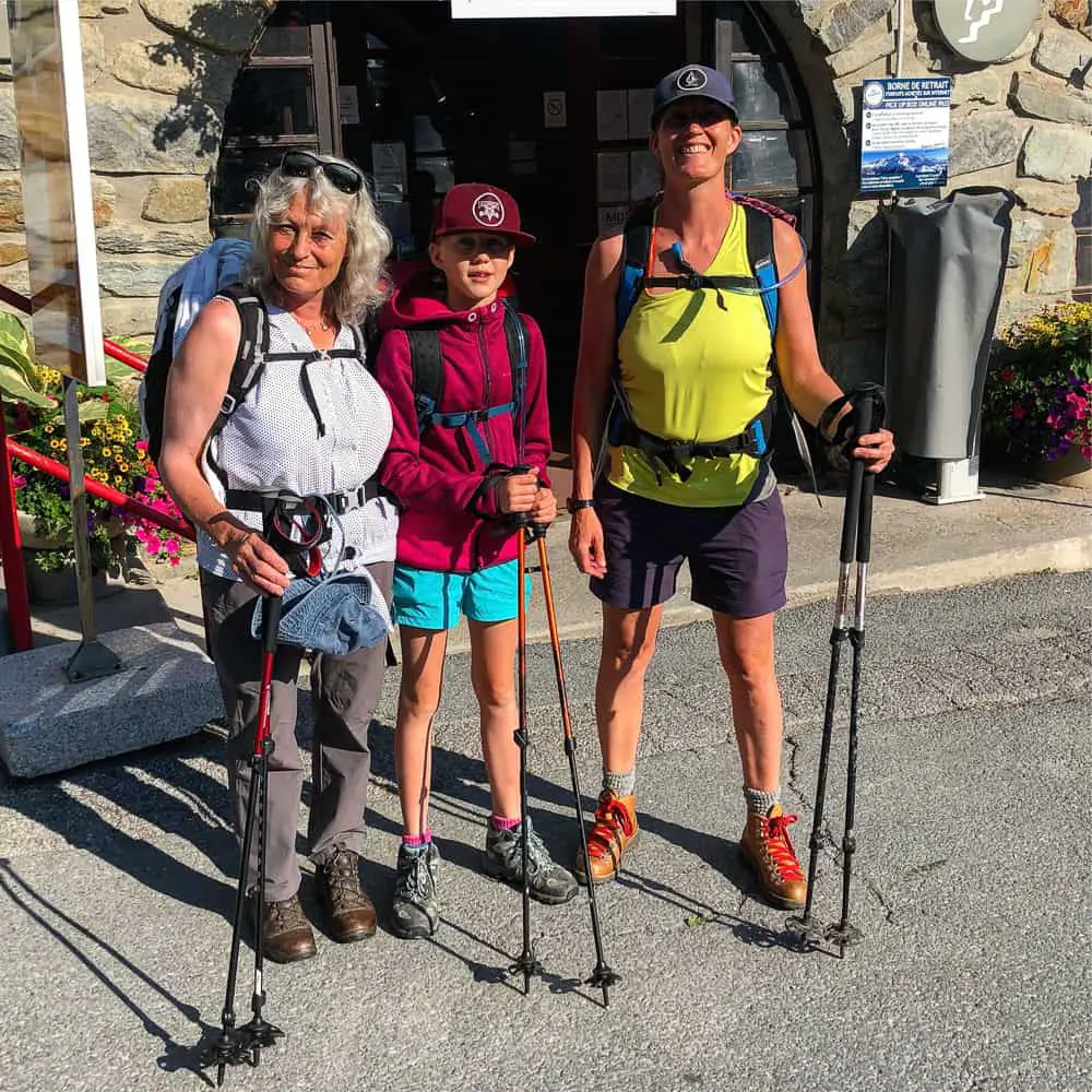
For us it was day 3 as my daughter and I had already done the last couple of stages as day hikes from our home in Chamonix. My Mum flew in to join us in the 4 day hike from Les Houches to Courmayeur so we were excited (and a bit nervous) to be a trio spanning three generations!
Short Cuts
As we’re hiking the tour with a 10 year old, in a bid to make it doable and enjoyable, we’re taking all available transport options. I would highly suggest this if you are contemplating hiking the TMB with kids.
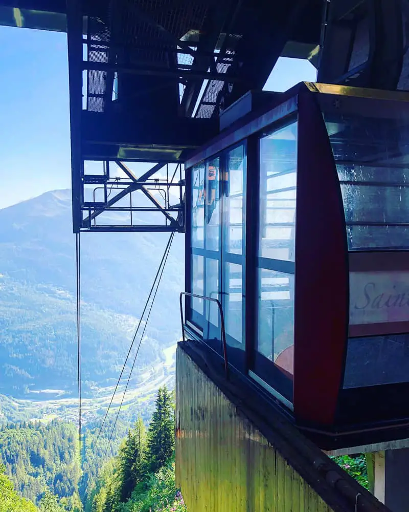
Short cut 1 – Bellevue cable car
The Bellevue cable car at Les Houches cuts out at least two hours of an uphill shleck to Col du Voza on the traditional route. For 14.5 euros (adult) you can cut this section out by taking the Bellevue cable car up to the Bellevue plateau. It’s then just a 20-30 min walk to pick up the main trail. Alternatively you can take the Tramway du Mont Blanc from St Gervais to Col du Voza, but you would need to get a taxi or a bus down the valley from Chamonix to St Gervais for the starting point, which seemed like more of a faff than it was worth.
Short cut 2 – public bus from Le Chapelle to Les Contamines & onto Gorge du Notre Dame
This public bus along the valley floor cuts out 1 hour of hiking into Les Contamine and a further hour if you take it all the way to Gorge du Notre Dame (5.8km of the trail).
Take the Bellevue cable car in Les Houches to cut a good 2 hours of uphill off your trail time today
This short cut turns the first day into mainly downhill taking us approximately 5 hours to Les Contamines. From there catch first the bus on the main road into the centre of Les Contamines which then carries on through Les Contamines and onto Notre Dame de Gorges, the end of the Monjoie Valley, where the trail continues off road up to the first refuge on this section of the trail – Nant Borrant.
We chose not to stay in Les Contamines and continue an hour up the trail as the next stage (tomorrow) is difficult and long with two cols to climb. There are no short cuts from Notre Dame de Gorge to Les Chapieux so we figured we’d try to get ahead on the trail the day before, plus we eager for a mountain hut experience.
We catch the cable car up just before 9am, but I’d recommend setting off at least at 8am everyday as the earlier you reach your accommodation to relax, the better (especially with kids).
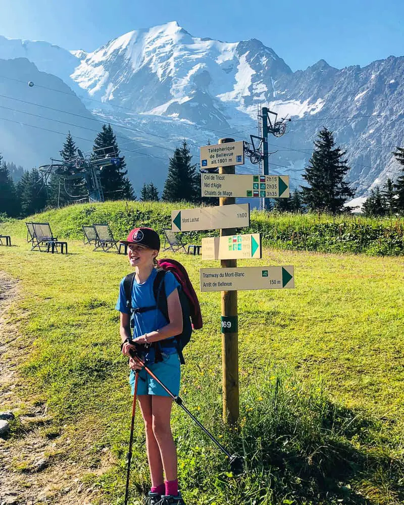
The Bellevue cable car whisks you up to the Bellevue plateau. From here it’s only a 20 minute walk to pick up the main TMB track
The cable car only takes around 6 minutes to reach the Bellevue Plateau (1801m).
Use the toilets at the top and get ready for the trail. Take the obligatory photo in front of the first sign post with the stunning view of the Dome du Gouter and the Aiguille Bionnassay in the background.
You’ll be following the green TMB signs (which are frequent and well marked) so head downhill to the right signposted Col du Voza. Most signs give you an average hiking time. Whilst this is quite accurate for adult hikers, we found we were adding at least half an hour onto this section. For example it took us almost 2 hours to reach Bionnassay (the signpost indicates 1hr 15 mins).
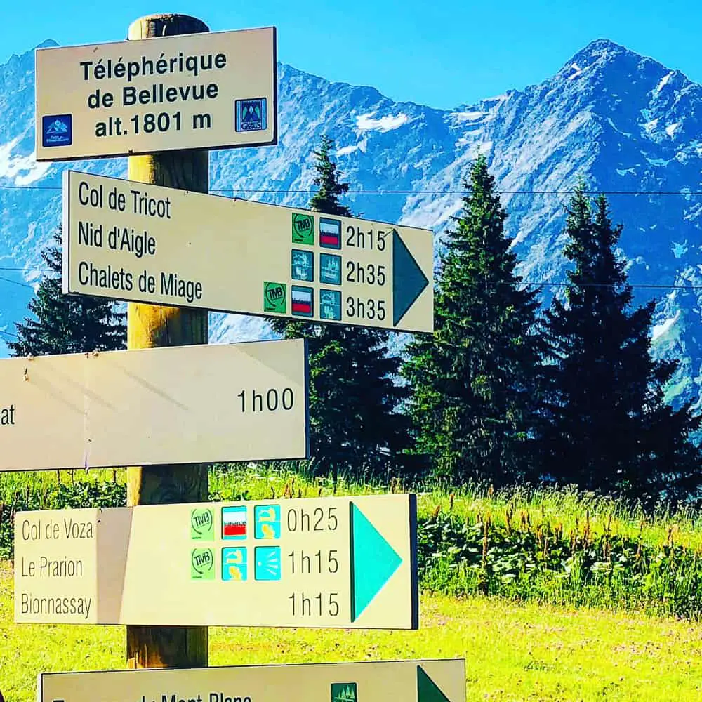
The Tour du Mont Blanc trail is well signposted. Many signs also tell you average walking times which are fairly accurate
The track is wide and easy as you walk with your back to the Dome du Gouter and Aiguille de Bionnassay. (you can’t quite see Mont Blanc from this angle).
The meadows have cows contentedly grazing with giant bells jangling around their necks secured by wide leather straps. We stride forward to the sound of the pleasant jingling of cow bells – a real alpine feeling that will forever remind us of the Tour du Mont Blanc.

The Bellevue hotel stands empty and alone on the Bellevue plateau. Skirt round it to pick up the main TMB track
Fifteen minutes on and the trail approaches and passes the Bellevue hotel which stands out like a lone soldier on the plateaux. The path continues through meadows of wild flowers down to Col du Voza, where before you the wide ski pistes of the winter dissect the woodland in two.
After half an hour you’ll reach the charming tiny restaurant of La Rioule. We love it here in the Winter where it’s a magical, authentic Savoyarde restaurant crammed with only a few tables, a roaring fire and friendly locals. Today though, with many hours ahead of you on the trail, don’t even think about a stop here unless you’re desperate for an expresso to kick start your day.
Chairlifts, empty and silent, hang over the Col du Voza – a hive of winter ski activity come December
From La Rioule restaurant, you’ll be heading in the direction of Bionnassay and Champel.
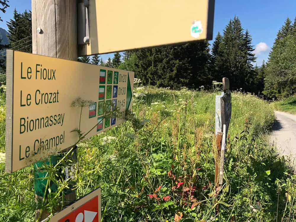
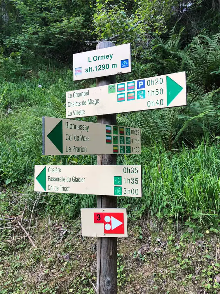
To get a grips with hike times with kids, take a look at the sign below. It might help you to figure your timings. I know I was worrying about how long the stages would actually take with kids so I made sure I recorded our times most of the way, so I could pass this knowledge on.
The sign states 20 minutes to Le Fioux – it took us 30 mins. For Le Crozat it states 30 mins, it took us 1 hr & 12 mins. Whilst for Bionnassay it states 45 mins but took us 1 hr 23 mins. Le Champel took us 2 hrs 50 mins but the sign says 1hr 30.
>>>>> – – – – – >>>>> – – – – – >>>>> – – – – – >>>>> – – – – – >>>>> – – – – – >>>>>
Read our
Tour du Mont Blanc Packing List
>>>>> – – – – – >>>>> – – – – – >>>>> – – – – – >>>>> – – – – – >>>>> – – – – – >>>>>
Tour du Mont Blanc hike times
The track is wide, downhill and pleasant. Not difficult at all. To your left the the stunning vistas of the Aiguille du Bionnassay come back into view and with the walk descending through meadows of wild flowers, we are in good spirits, our feet fresh and strong.
The complete TMB circuit is approximately 107 miles (170 km) and has an altitude gain and loss of over 6.2 miles (10 km) …. which is more than the height of Everest.
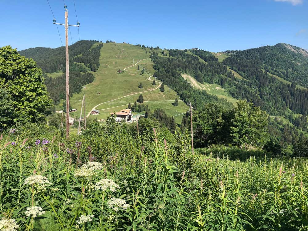
Facing you you’ll now see the laces of ski slopes winding down the “Evasion” ski area which joins the ski pistes of both Megeve and Les Contamines – a huge skiable area come winter.
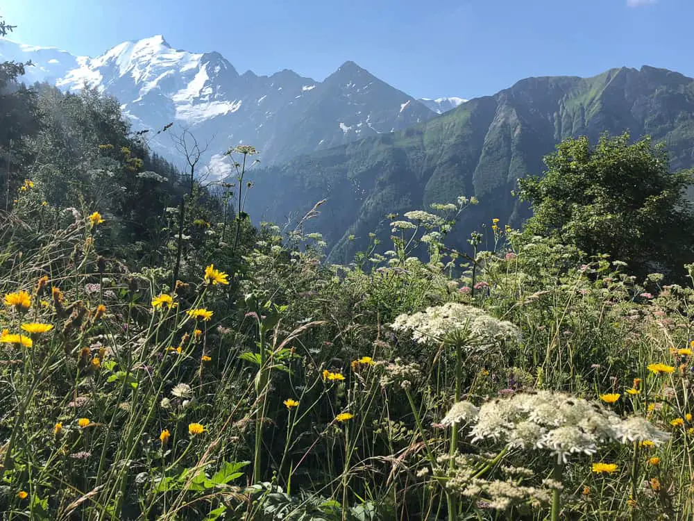
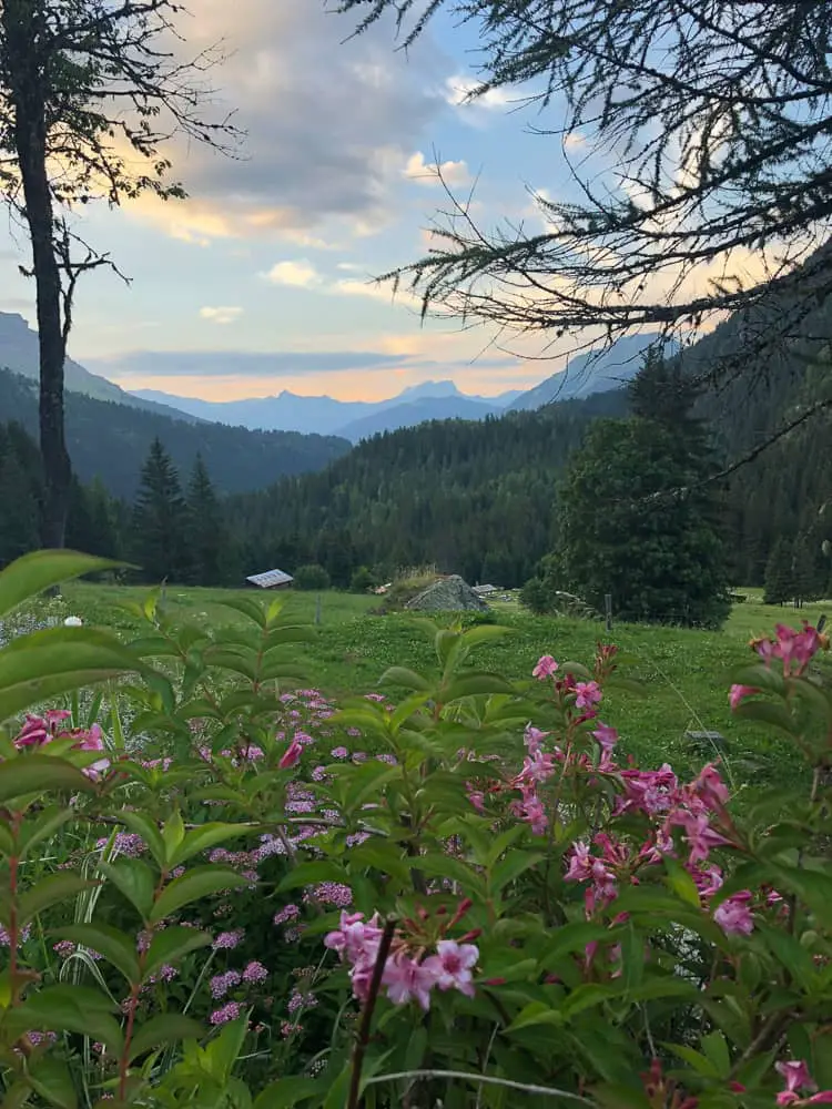
Stage 1 of the Tour du Mont Blanc trek meanders through pleasant alpine pastures and charming villages to a backdrop of the majestic peaks of the Alps
Ahead is the Montjoie Valley and once you’ve curved you’re way around the wooded hillside, you’ll be heading down towards Les Contamines, the traditional first night stop off on the TMB.
Did you know that there’s a refuge around every 5 kilometres along the Tour du Mont Blanc trail?
We walk past a couple of chalets adorned with bright cheerful geraniums and realise we’re in La Fioux. Refuge du Fioux (below) allows you to pitch your tent in their garden for 5 euros per person.
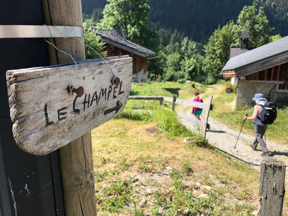
Le Champel is just one of the tiny hamlets you’ll stroll through on stage 1 (day 3 of our TMB itinerary) from Les Houches to Les Contamines
Before you can blink our legs have stomped on past and we’re en route to Le Crozat, what looks like a gathering of farm buildings and a junction of paths.
>>>>> – – – – – >>>>> – – – – – >>>>> – – – – – >>>>> – – – – – >>>>> – – – – – >>>>>
Read our post
Tour du Mont Blanc Refuges – the Good, the Bad and the Ugly
>>>>> – – – – – >>>>> – – – – – >>>>> – – – – – >>>>> – – – – – >>>>> – – – – – >>>>>
A signpost next to the Le Crozat parking shares it’s altitude with us, 1420m and gives us options to turn left up to the Refuge de Bionnassay, perched up high at the foot of the Bionnassay Glacier. It’s not our route today, but I take note of it for another hiking adventure in the future.
We carry on following the sign towards Bionnassay and before long (2 hr from the start of the hike from the top of the Bellevue Plateau) we reach the small hamlet. Follow the signs to Le Champel. We pass a tiny church with bars on the window, which was sadly locked up so we couldn’t glimpse inside.
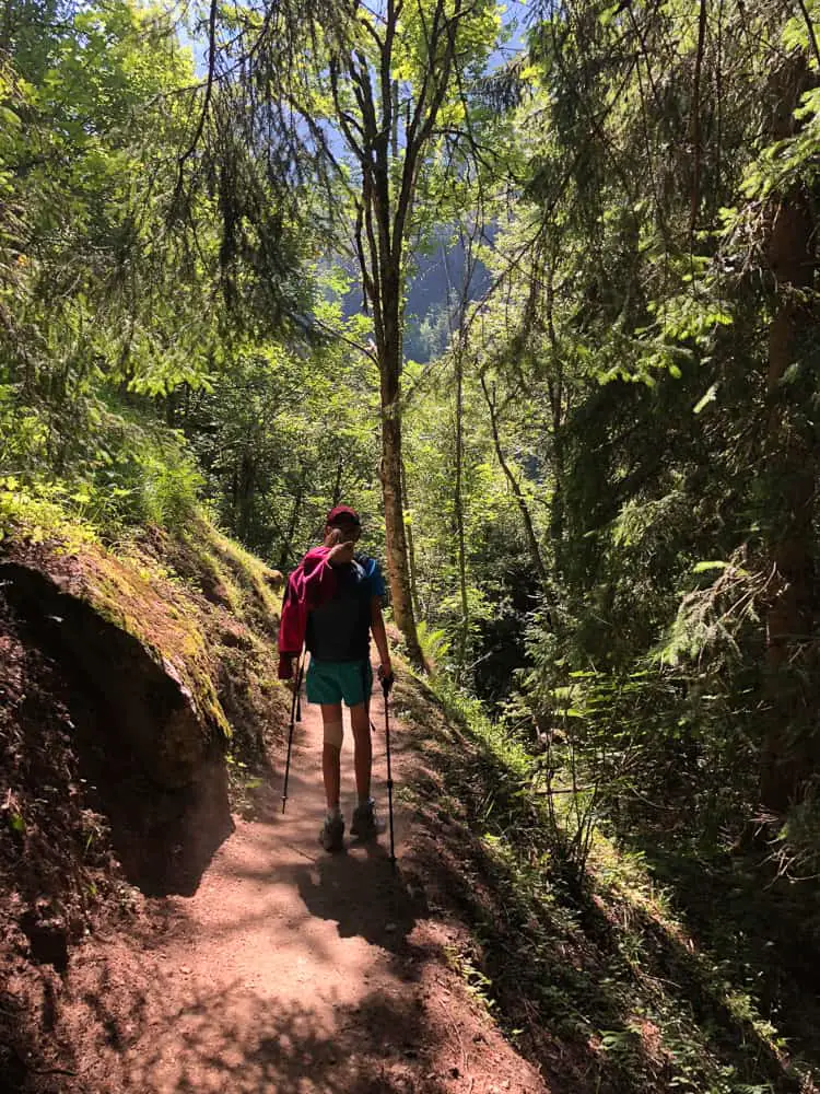
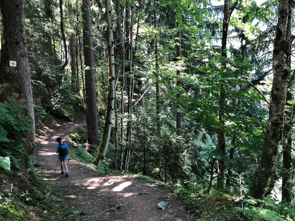
 The trail then descends down into a woodland, which is our first shade of the day and a welcome break from the sweltering sun.
Did you know Mont Blanc is “owned” by both France and Italy under a bilateral agreement and is called Monte Bianco in Italy ….
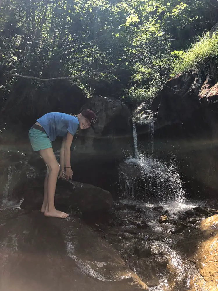
 Fifteen minutes later the path crosses a glacial stream. The perfect place to soak hot, sweaty feet. Whilst TMB days are long and there’s a certain pressure to keep going, I would highly recommend a 5 minute stream foot soak to anyone.
>>>>> – – – – – >>>>> – – – – – >>>>> – – – – – >>>>> – – – – – >>>>> – – – – – >>>>>
Read our post
Shortcuts via public transport on the Tour du Mont Blanc
>>>>> – – – – – >>>>> – – – – – >>>>> – – – – – >>>>> – – – – – >>>>> – – – – – >>>>>
At first I was intent on putting the miles under us, wary of how long the trail ahead was and hoping to get some miles under us while our legs were still fresh. Think again. A ten minute break here in the shade was much needed. Our swollen, hot feet, refreshed were revived ten fold!
 It’s important to look after your feet on the TMB. Fact. Once you’ve got blisters, your TMB is going to become very uncomfortable and much less enjoyable. Take a heap of compeed with you (buy them in the UK – the French don’t sell them).
Wind a small amount of duck tape around a pencil to stick onto ‘heat points’ on your feet before they get to blister stage.
From here it’s a steep uphill for ten minutes upon where you’ll hit a main track traversing the mountain side at L’Ormey (1290m).
 Turn right here and follow the wide vehicle track through shaded forest which gently descends into the hamlet of Le Champel.
Did you know the snow left on the trail in summer is called névé. Névé is granular snow accumulated on high mountains that has been partially melted, re-frozen and compacted
The route is pleasant under the trees. This stage is all quite gentle downhill (if you’ve of course taken the Bellevue cable car up!).
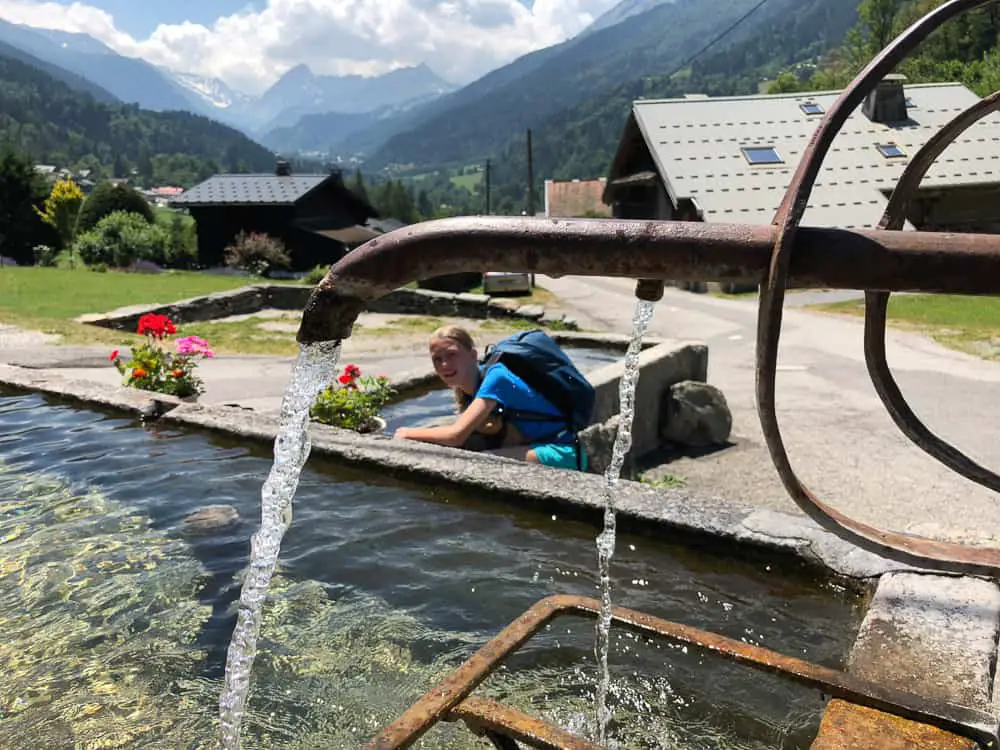
This part of the TMB gently meanders through alpine meadows and charming French villages complete with obligatory water troughs, which are all drinkable and perfect for filling up your water bottles.
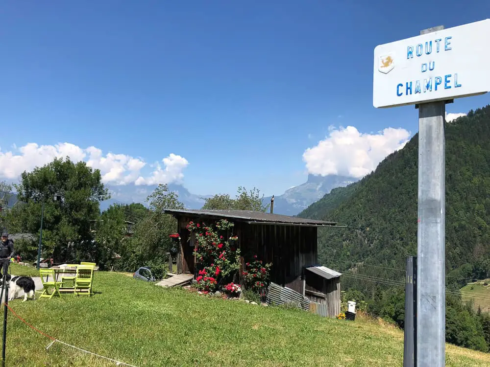
Arriving in Champel, another quiet hamlet. There seemed to be one place to stay here and perhaps eat but as we’d packed our picnic for day 1, we pressed on after taking a photo of this cute little cabin. We’d definitely recommend packing a picnic the first day.
Food en route can really add up and although it’s necessary to buy packed lunches from the refuges or eat in refuges along the route, for the first day it’s easy to bring a packed lunch.
Stock up with loads of light snacks that will keep you going for the first couple of days. We packed loads of beef jerky (biltong) which is super light and high in protein, as well as lots of cereal bars and dried fruit.
 After passing through Champel, follow the tarmac road down for five more minutes and on the first hairpin veer off to the left at the little bus stop (the path continues just next to the no entry sign in the photo below).
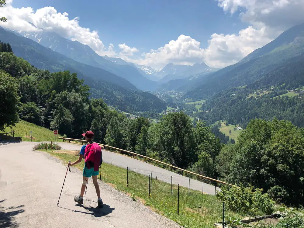
Make sure you take in the beauty of the entire Montjoie Valley ahead of you as in these few brief minutes as you round this hairpin bend coming out of Champel, for it’s the only time you’ll see the valley from this birds eye angle.
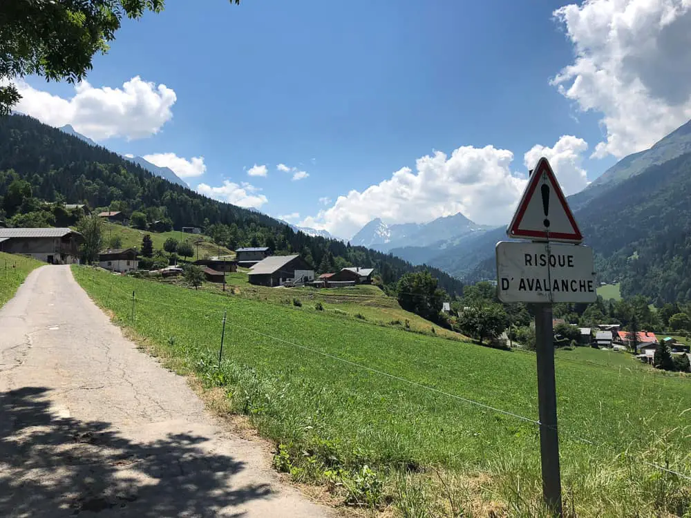
Incredibly you can see the Col du Bonhomme right at the end of the valley covered in snow. You’ll be climbing that Col tomorrow when the trail suddenly gets serious. Gone are the charming villages, replaced by exposed high mountain bluffs and pure alpine wilderness.
The trail crosses a field and disappears into the trees. There’s a signpost which is clearly marked to La Villette.
 The footpath becomes wider once you hit the trees and descends down a very steep wide trail which is wonderfully shaded. We stopped to have lunch here underneath the shadows of the trees amongst the moss.
>>>>> – – – – – >>>>> – – – – – >>>>> – – – – – >>>>> – – – – – >>>>> – – – – – >>>>>
Did you know you need to have a sleeping bag liner to stay in the TMB refuges?
Read our RAB silk sleeping bag liner review
>>>>> – – – – – >>>>> – – – – – >>>>> – – – – – >>>>> – – – – – >>>>> – – – – – >>>>>
Fifty minutes after leaving tiny Champel, La Villette, a large collection of charming wooden chalets, will appear.
With the verdant Monjoie valley ahead, you will be skirting the mountainside to the left along a trail that will take you almost to Les Contamines before dropping down next to the main road that winds through the valley. It’s here that we suggest you pick up the public bus and save your legs. The bus will save you a one hour trek into Les Contamines and if, like us, you’ve booked into the Nant Borrant refuge, you’ll need that energy to deal with the long, steep climb up to the refuge.
All the hamlets we passed through were extremely quiet. We hardly saw a soul apart from other TMB hikers.
 However, we were hot now and the trail seemed long with the sun beating down on us. I regretted not setting off an hour earlier.
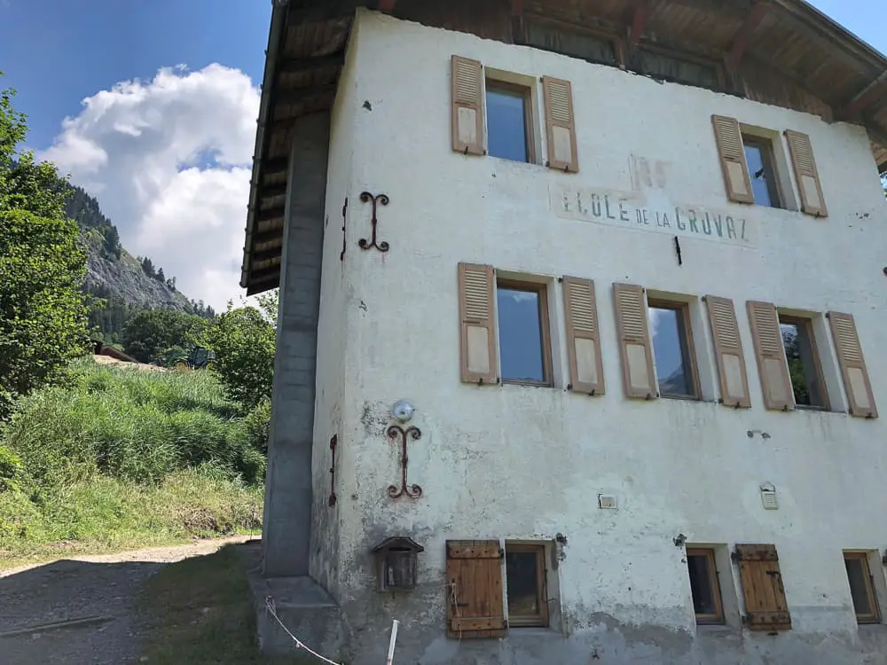
The trail from La Villette takes you onto La Gruvaz and when you arrive at the old building of Ecole de la Gruvaz, your heart will sink as your faced with an uphill climb.
 It’s an unwelcome 10 minute struggle up to La Gruvaz parking (1085m) in the blazing heat and it’s a welcome relief to reach La Gruvaz Gorge parking area where the trail once again thankfully disappears into the trees.
It’s a 20 minute gentle descent through the shady woodland to the hamlet of La Tresse where the trail meets the main road.
 Now here you want to pick up the public bus to avoid a further 1 hour hike into the town of Les Contamines. The TMB track continues immediately over the main road and disappears into the woodland on the opposite side of the valley.
The bus would whisk us in 15 minutes up to Les Contamines and straight onto the Gorge du Notre Name where the TMB trail continues, cutting out 5.8km of hiking. The trail from here to Les Contamines is not really note worthy (we know because we made a mistake with the bus and actually ended up having to hike the trail in the end).
We waited for the bus at La Tresse for some time. Several buses went past us without stopping and we were confused as the bus timetable on the bus stop clearly showed a bus was due. Resting in the shade of the bus shelter was a welcome break but after over an hour of no bus arriving, we were finally forced to lug on our backpacks once more and reluctantly took up the TMB trail again. The trail avoids the main road, cutting between the woodland on the far side of the valley and is not very note worthy at all.
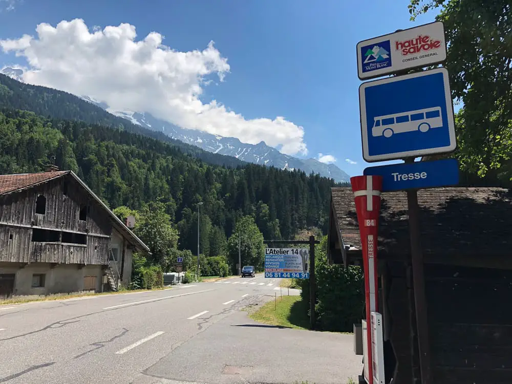
It turns out, the bus drives in a loop most of the day from Notre Dame de la Gorge to La Chapelle, only dropping down to La Tresse a couple of times a day. It turns out that the wrong timetable had been put up at La Tresse by the tourist office. So if you want to catch this bus (and we recommend you totally should hiking with kids), walk up the main road to the next bus stop – La Chapelle to catch the bus.
If you’ve caught the bus from La Chapelle, then this should be the same one that will take you to Gorge du Notre Dame. If you’re already in Les Contamines, the free shuttle bus goes every half an hour from outside the Tourist Office to Gorge du Notre Dame, which is the end of the road and where the TMB route starts again. You can read more about this shuttle bus and all our short cuts on public transport in our post here.
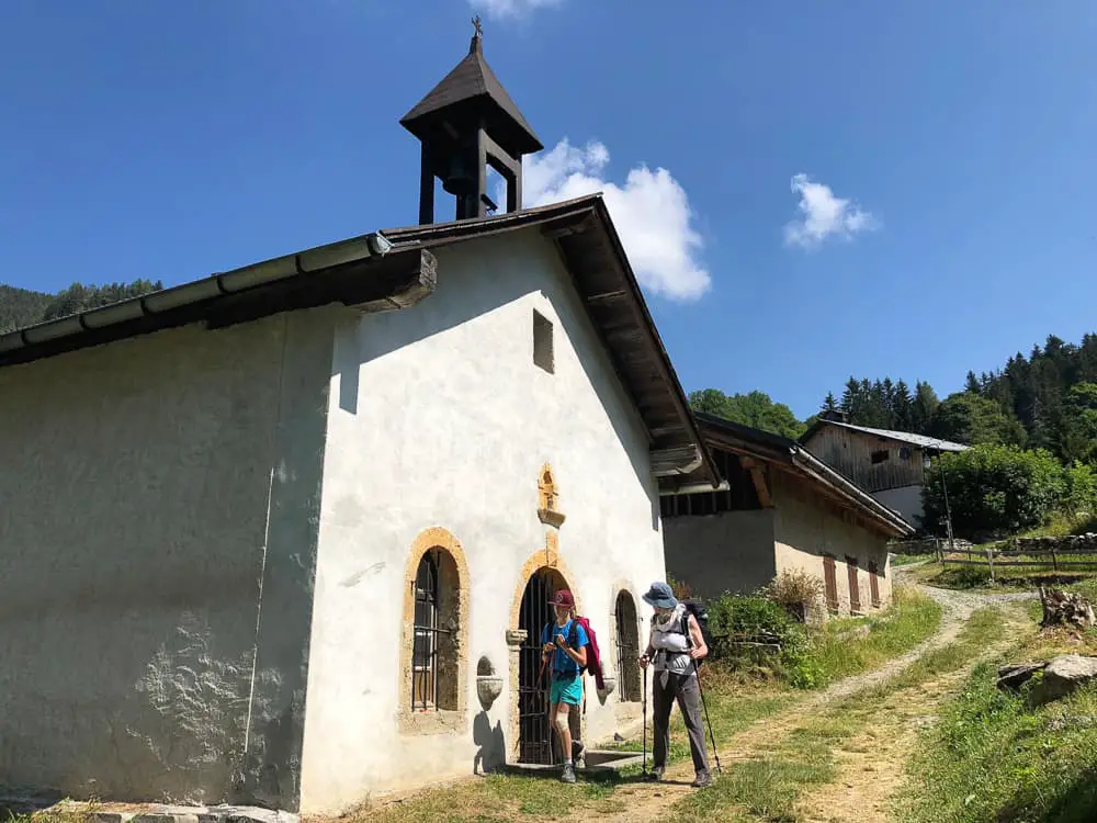
The bus will pull into a large car park where you’ll see a beautiful, ornate church. Note: there’s a good water trough to fill up in front of the church.
Cross the bridge spanning the river and turn right to begin the uphill one hour slog up to Refuge Nant Borrant.
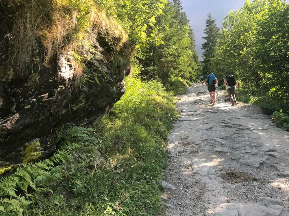 This ascent over Roman slabs will force the air from your lungs and finish you off for good!
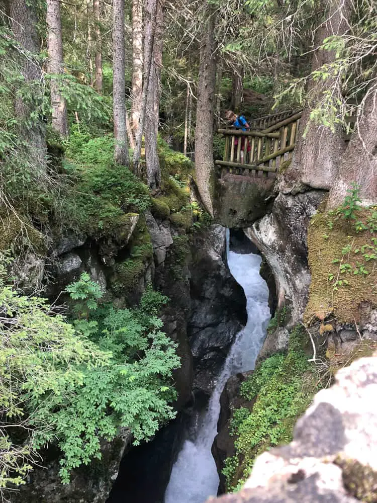
Look out for the sign post for the Pont Naturel on the right hand side. It’s a natural arch with the fast waters of the gorge rushing through and worth a couple of minutes stop to check it out.
Shortly after this, you’ll come to a perfect little Roman bridge, the Pont de la Téna, spanning the gorge with great views of the long vertical drop into the chasm below. There’s a good viewing platform along the opposite side.
 From the Pont de la Téna, it’s only 15 minutes walk to the Nant Borrant refuge.
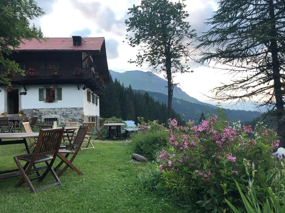
What a welcoming site it is to see this chocolate box chalet in the distance welcoming you with colourful geraniums spilling out from window boxes.
Refuge Nant Borrant is run by friendly Patricia and Pierre. This cosy refuge with five small dorms of between 5-9 beds, comes with rave reviews on Trip Advisor. We paid €43 per adult and €30 for a child for half pension (dinner, bed and breakfast).
You can book online easily on their website http://www.refuge-nantborrant.com.
 It was the trip advisor highly recommended reviews from TMB hikers that persuaded me to book in here. That and the chance to reduce an hour off one of the harder sections of the trail tomorrow. From here on, there are NO SHORT CUTS to Les Chapieux. Every single step needs to be climbed.
The warm, welcoming ambience of Nant Borrant was embracing after our long day on the trail. The hearty, delicious food (vegetable soup, beef stew and apple pie) polished down in no time at all. The smaller dorms are the perfect size for families (one with 5 beds and one with 6) and there was no problem with me specifically asking for one fo the smaller dorms when booking.
 The views are from Nant Borrant are stunning from their perfect location on the edge of the nature reserve (the Réserve Naturelle des Contamines-Montjoie) looking back down the valley.
It’s a great feeling to be an hour up on the next day’s hike and in hindsight I don’t know how we would have completed the next day without our insight to book at Nant Borrant.
Did you know you need to sleep in a sleeping bag liner in the TMB refuges? You can usually hire one for around €3 but we’d recommend taking your own.
We wriggle into our sleeping bag liners (we highly recommend the ultra light RAB silk sleeping bag liner) and fall into our comfy beds with a mixture of excitement and trepidation of the trail ahead. Popping in our ear plugs (an absolute must in refuges) we are soon dozing contentedly.
Related TMB content
Read day 1 (stage 10) Tré-le-Champ to La Flégère
Read day 2 (stage 11) La Flégère to Les Houches
Read day 3 (stage 1) Les Houches to Les Contamines (& onto Nant Borrant refuge)
Read day 4 (stage 2) Nant Borrant Refuge to Les Chapieux
Read day 5 (stage 3) Les Chapieux to Refugio Elisabetta
Read day 6 – Tour du Mont Blanc – Stage 4 – Rifugio Elisabetta to Courmayeur
Tour du Mont Blanc Packing List
Ultimate guide to your self guided Tour du Mont Blanc
Tour du Mont Blanc Refuges – the good, the bad & the ugly
Tour du Mont Blanc Difficulty? Transport options on the TMB
9 comments
Awesome picture’s, and description of your travels.Can you please tell me if the are trail head parking for these parts of the TMB? I am looking for some loop trails and up and back trail for hiking this summer, end of July thru August 2019. My oldest sister will travel with us in HAUTE SAVOIE, SAVOIE REGION of France, so we’re looking for ideas on Easy to Moderate trails in difficulty. Villaz will be our base camp, and we will drive each day for hiking. Total round trip time for hikes can be as long as 5 or 6 hours, as we will pack our lunch and snacks. Thank you ! Allan Ray Parmley, Lyon France .
Hi Allan. Some of the TMB sections have parking but not all have trail loops. For example there is a large car park on the Col des Montets pass in France, near the Swiss border, where you can start Stage 10 (anti-clockwise) Tré-le-Champ to Refuge de la Flégère. Note that this refuge and the Lac Blanc refuge are closed for this summer, but walking up to Lac Blanc is a wonderful hike with incredible views. You could walk a loop around if you took the normal route (via the ladders) up to Lac Blanc and return the alternative route back to Col du Montets. The alternative route is for those who have an aversion to heights and so want to avoid the ladders. Have a look at the ladders on my dedicated post here https://thefamilyfreestylers.com/tour-du-mont-blanc-difficulty-ladders/ to see whether you fancy that route or not. If you feel you are able to tackle the ladders then this is a lovely 5-6 hour route.
I don’t know Villaz personally but I am sure there are some lovely walking routes around there. Good luck. Happy hiking
My mum and I are gonna home Les Houches to Courmayeur and hoping to do it in three days and stay at maison vieille on the last day. I’ve read your post but the refuge u stayed in after walking from Les Houches is full… can u recommend another one maybe a bit further so we can do it all on three days…? Been googling but getting confused..
Hi Amanada.
We stayed in Nant Borrant which is the first refuge after Les Contamines. If that’s full, you have two options, staying in the town of Les Contamines (which is what most trekkers do). We only walked up to Nant Borrant as we wanted to cut out an hour of day 2 which is pretty hard with two cols to climb. If you want to press on the trail further, it would be best to try to book into the next refuge – Refuge de la Balme. We didn’t stay there and we had heard it’s not one of the best refuges but location wise, it’s perfect. It’s about an hour past Nant Borrant.
If you really only have three days I would advise you to miss the Les Houches to Les Contamines stage and start at Les Contamines. Squeezing the entire Les Houches to Courmayeur into 3 days is pretty tough and I’m not sure you’d have any time to actually enjoy the route. You’d be putting in long hard days (and the days are already long and hard doing it in 4 days!). Les Contamines to Courmayeur is the most spectacular scenery so missing out the meadows, farms and rolling countryside between Les Houches and Les Contamines is no real biggy.
Hi Mags
Firstly, I just want to say how terrific the Family Freestylers is. So informative and inspiring. Thanks for sharing such great information and photos with the rest of us. I would love your advice about trekking in France with my family next July. There are 6 of us, including four kids aged 10, 13, 14 and 16. We are an Australian farming family so we’re accustomed to being outdoors and we’re all pretty fit but the kids aren’t experienced multi-day walkers. I had hoped to do a 5-7 day walk in the Mount Blanc region but I’m concerned that the 7-10 hours of walking per day may turn the kids off trekking for life! I want them to love it and to experience the euphoria of mountain walking.
I have always loved the independence of walking self-guided, and this is also a better option for us from a cost point of view.
Can you recommend a fabulous 4-7 day walk in the French Alps through magnificent scenery, with accommodation en route?
Thanks so much for your help. (I don’t know the Alps at all, and it’s difficult to work out what’s best from internet. Your information stands out!)
Rosie
Hi Rosie. Great to hear from you and thank you for your kind words! I think a section of the Tour du Mont Blanc would work really well for you guys. I would trek from Les Contamines to either Lac Combale or to Courmayeur. These TMB days are certainly the most adventurous and striking mountain scenery. I agree hiking such long days isn’t so much fun for kids and actually in hindsight, I would have cut our days down a bit had I known it would have taken us so long – it was difficult to plan ahead with the information I had on the internet at the time …. which is why I decided to write so much about it after we came back 🙂
I helped a friend of mine plan her trip with her young children (5, 9 and 11 and it worked really well. I would suggest starting in Les Contamines instead of Chamonix, as this section is long and not particularly striking.
Day 1 – Base yourself in Chamonix for stunning alpine scenery. Leave your baggage at your hotel while you trek 3-4 days on the TMB. Catch a taxi to Les Contamines from Chamonix rather than taking the bus (it takes a fair few hours with connections so it’s a bit of a pain) Stay the night in Les Contamines.
Day 2 – hike from Les Contamines and stop the first night at the Refuge du Col du Bonhomme. Now this refuge is the only down side of this shorter stage itinerary. It ISNT the best refuge on the trail by a mile – in fact it’s super basic and the food is awful (I’m not selling it am I! 🙂 ) but from a location point of view it’s the perfect stop time wise. It’s a rough HUGE basic refuge, it’s super exposed and at high altitude but if you book a private room, instead of a dorm, and be prepared that the food is going to be awful (there’s also no electricity at night so expect candle night dinner) and see it as an adventure then you will be fine.
Day 3 hike from Refuge de la Col du Bonhomme to Refuge Mottets (just past the hamlet of Les Chapieux) – it’s newly converted and has excellent facilities and food! Yay.
Day 4 hike from Refuge Mottets over the Col de la Seigne into Italy. Stay the night at Refugio Cabane Combale (Italy) – this is lovely refuge with ensuite rooms and good food.
Day 5 Then you can decide to hike to Courmayeur (it’s quite a long stretch) or take the bus from near Cabane Combale (50 min walk to the village of Visaille) where you can catch a bus to Courmayeur. Stay here the night and then catch the bus back through the Mont Blanc tunnel to Chamonix OR if the weather conditions are good – catch the Skyway/Helbronner/Chamonix cable cars back over to Chamonix. This is expensive but incredible – often closed due to wind.
I would advise you to buy the Trekking the TMB book by Kev Reynolds. This will allow you to look at the route and learn about the stages between the refuges I’ve suggested. If you have any other questions on this route, please feel free to contact me. Cheers. Mags
You are a gem, Mags. Thanks so much for your advice. I’ll look at the route you suggest and come back with any further questions.
Keep adventuring and inspiring us to do the same.
You’re welcome Rosie! Give me a shout if you have any questions 🙂
Hello, thank you for your detailed description, I used it to plan our TMB trek and it was so helpful!!! Again, thanks to you, everything went so well!!!